Trait - Spatial
Intended audience: ANALYSTS DEVELOPERS ADMINISTRATORS
AO Platform: 4.3
Overview
Automatically creates a spatial object from the location Trait fields selected, such as from Latitude, Longitude values, Address field, or a Geometry field.
This allows for downstream location operation, such as distance calculation and finding locations with a spatial area, as well as rendering of location data on a map - either as individual map features, or as clusters.
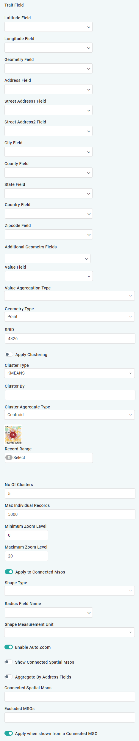
Trait Fields
Label | Description |
|---|---|
Latitude Field | Add a Property Field containing a Latitude value expressed in decimal degrees, eg. 48.85826. Value range is from -90 to 0 (southern hemisphere) and 0 to +90 (northern hemisphere). 0 equals Equator. |
Longitude Field | Add a Property Field containing a Longitude value expressed in decimal degrees, eg. 2.29450. Value range is from -180 to 0 (west of the Prime Meridian) and 0 to +180 (east of the Prime Meridian). 0 equals Prime Meridian. |
Geometry Field | Add a Property Field containing an actual spatial geometry value. Such values typically comes from Spatial databases, such as Oracle Spatial, PostGIS, and others and will include both Latitude and Longitude values to form a coordinate that can be used directly to show the record on a map. |
Address Field | Add a Property Field containing an Address, ie a value containing a street name, postal code, city, country. This will allow the Spatial trait to do “reverse geocoding” which means to find the nearest known coordinate and thereby be able to show the Address on a map. |
Street Address1 Field | Add a Property Field containing a specific first line of a Street Address. |
Street Address2 Field | Add a Property Field containing a specific second line of a Street Address. |
City Field | Add a Property Field containing the City of an Address. |
County Field | Add a Property Field containing the County of an Address. |
State Field | Add a Property Field containing the State of an Address. |
Country Field | Add a Property Field containing the Country of an Address. |
Zipcode Field | Add a Property Field containing the Zipcode of an Address. |
Additional Geometry Fields | Repeater for configuring additional Geometry fields in case the data source have multiple Geometry Fields for a single record. |
Value Field | |
Value Aggregation Type | Dropdown with these options: Sum, Cunt, Countdistinct, Max, Min, Avg, Expression, Stddev, Stddevpop, Variance. |
Geometry Type | Add the type of Geometry, such as: Point, Line String, Polygon, Multi Point, Multi Line String, Multi Polygon, Geometry Collection, Envelope. |
SRID | This is the Spatial Reference ID which is a reference for how the coordinate values are interpreted. The AO Platform interpretes map features using the SRID representing the Global Positioning System WGS84 standard. Default is: 4326. |
Apply Clustering | ON/OFF Toggle, default is OFF. |
Cluster Type | Dropdown with these options: KMEANS, DBSCAN, GRID, HEXAGON. |
Cluster By | |
Cluster Aggregate Type | Dropdown with these options: Centroid, Boundary. |
Cluster Icon | Add an Icon to be used to represent a cluster on the map. |
Record Range | Select one or more Record Ranges from options available in dropdown. |
No of Clusters | Default is 5 clusters. |
Max Individual Records | Default is 5000 records. |
Minimum Zoom Level | Default is 0 |
Maximum Zoom Level | Default is 20 |
Apply to Connected MSOs | ON/OFF Toggle, default is ON |
Shape Type | Dropdown with these options: Circle, Ellipse, Rectangle, Arc, Squircle, Super Circle. |
Radius Field Name | |
Shape Measurement Unit | Dropdown with these options: Millimeter, Centimeter, Meter, Kilometer, Foot, Inch, Yard, Mile, Fathom. |
Enable Auto Zoom | ON/OFF Toggle, default is ON |
Show Connected Spatial MSOs | ON/OFF Toggle, default is OFF |
Example Visualizations - using Advanced Map App
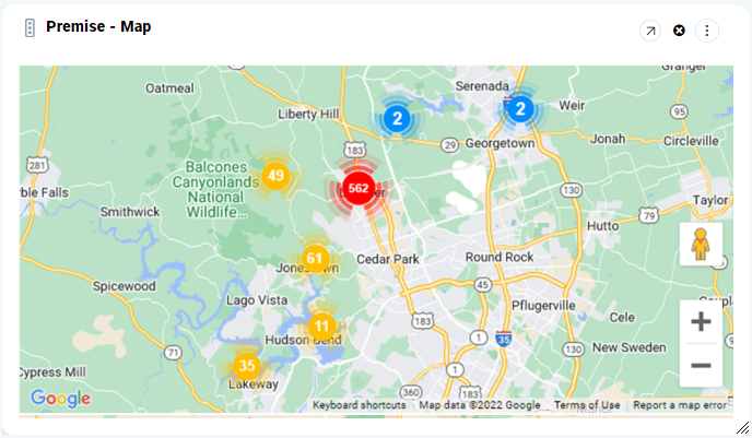
Clusters are shown on a Road Map background.
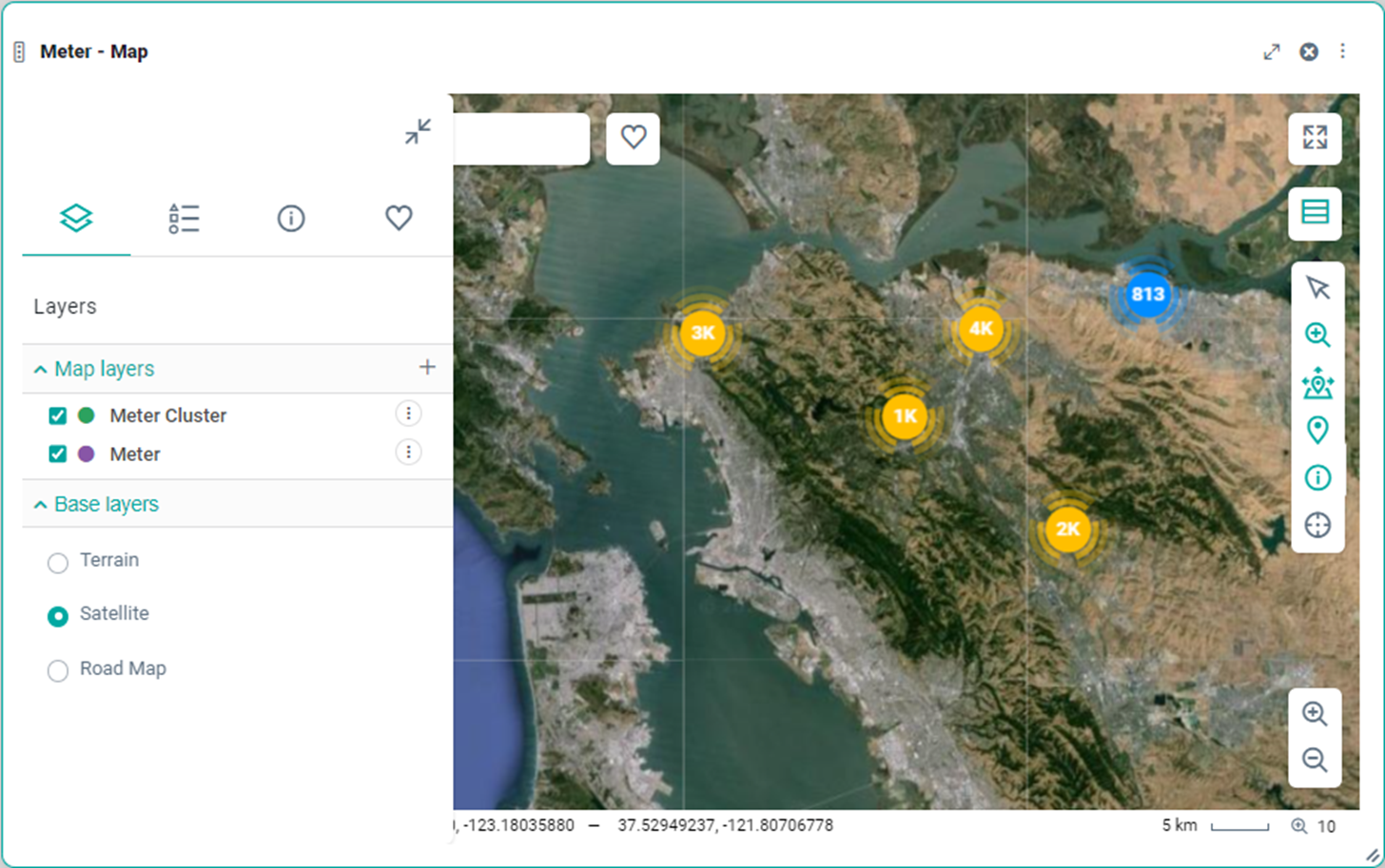
Clusters are shown on a Satellite Map background.
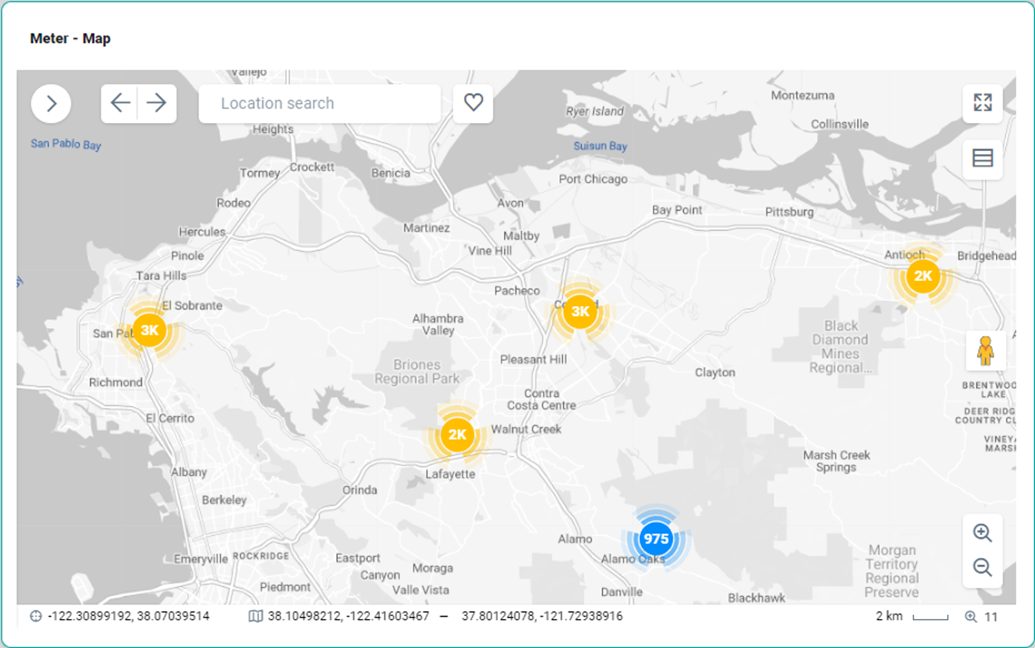
Clusters are shown on a Terrain Map background.
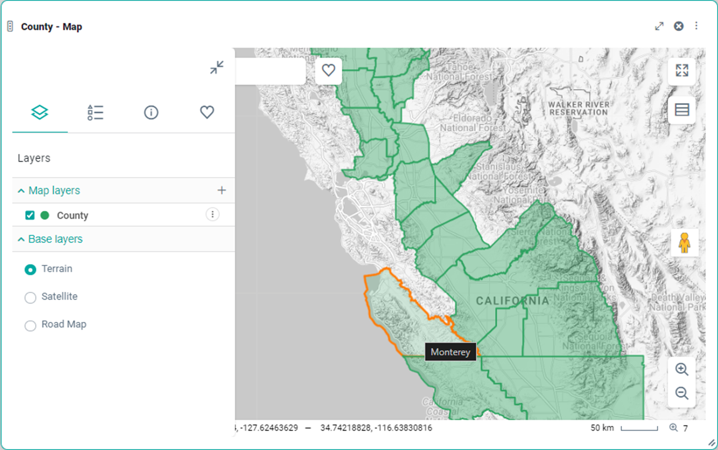
Polygon boundaries are shown on a Terrain Map background.
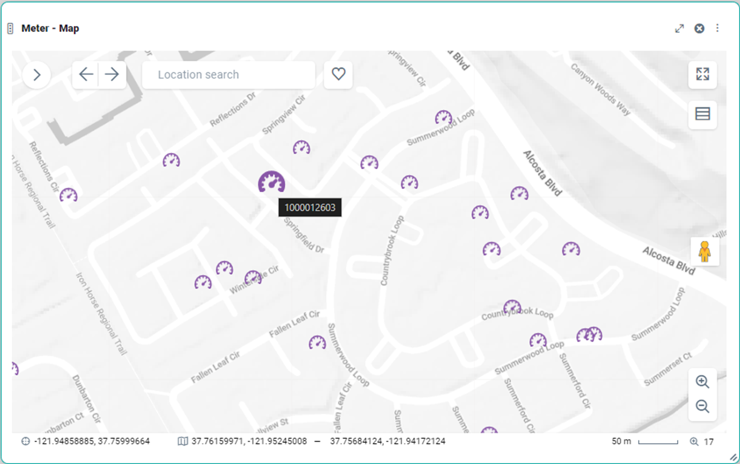
Individual point data with links to data.
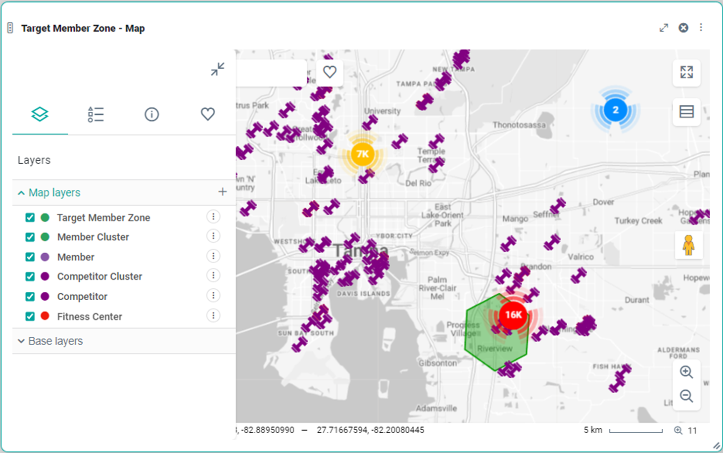
A mix of polygon boundaries, points, and clusters.
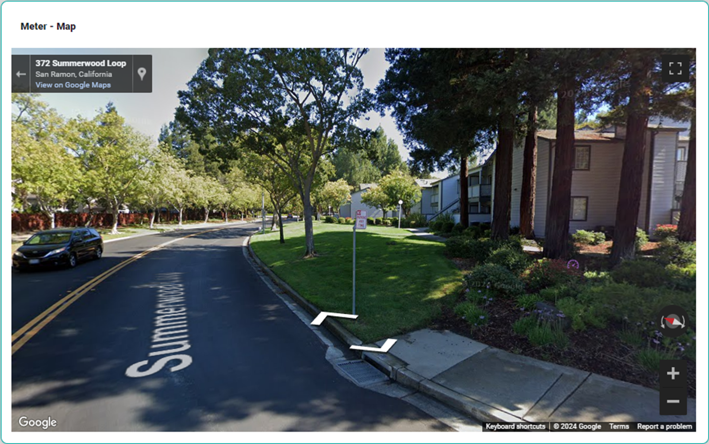
Google StreetView.